
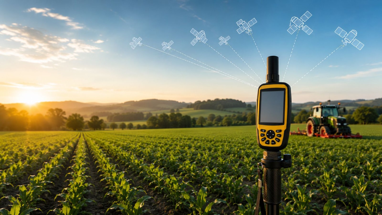

Positioning accuracy matters more than most people realize, until it doesn’t work. Mapping farmland, staking out a construction site, running a land survey — in each case, a small error in position can turn into an expensive mistake down the line.
That’s the gap RTK GNSS was built to close.
Standard GPS gets you in the neighborhood. RTK GNSS gets you to the centimeter, in real time, which is exactly why it’s become the go-to choice for people working in surveying, construction, engineering, and precision agriculture.
If GNSS technology is new territory for you, this guide covers the essentials — starting with how satellite positioning works at all, moving into what RTK actually does, and why it’s reshaping the industries that depend on knowing exactly where something is.
Table of Contents
- What Is GNSS?
- What Is RTK?
- How RTK GNSS Works
- How Accurate Is RTK GNSS?
- Applications of RTK GNSS
- Land Surveying
- Precision Agriculture
- Construction
- Benefits of RTK GNSS
- RTK GNSS vs Standard GPS
- How to Choose an RTK GNSS Device
- How Dream Origin Supports Precision Positioning
- Frequently Asked Questions
- Conclusion
What is GNSS?
GNSS, short for Global Navigation Satellite System, is really just the umbrella term for satellite networks that hand out positioning, navigation, and timing data anywhere on the planet.
Rather than depending on one satellite network alone, GNSS devices can pull signals from several constellations at once, including:
- GPS (United States)
- GLONASS (Russia)
- Galileo (European Union)
- BeiDou (China)
Drawing on multiple systems tends to improve a handful of things at once:
- Position accuracy
- Signal availability
- Reliability in difficult environments
- Faster positioning
Most GNSS equipment on the market today is built to track several constellations at the same time, which keeps positioning steadier even near trees, buildings, or in mountainous terrain — places where a single-system receiver would start to struggle.
What is RTK?
RTK — Real-Time Kinematic — is a positioning technique that sharpens GNSS accuracy considerably by correcting satellite signal errors as they happen, rather than after the fact.
A standard GNSS receiver works out its position from satellite signals alone. The trouble is, those signals pick up distortion along the way: atmospheric conditions, small clock errors on the satellites themselves, and other sources of interference that creep in.
RTK gets around this using three pieces:
- A base station set up at a location whose coordinates are already known
- An RTK receiver, or rover, working out in the field
- A communication link carrying correction data from the base station to the rover
Once those corrections are applied, the rover can pin down its position to within a centimeter or so.
How RTK GNSS Works
Break it into steps, and the whole process gets a lot less abstract.
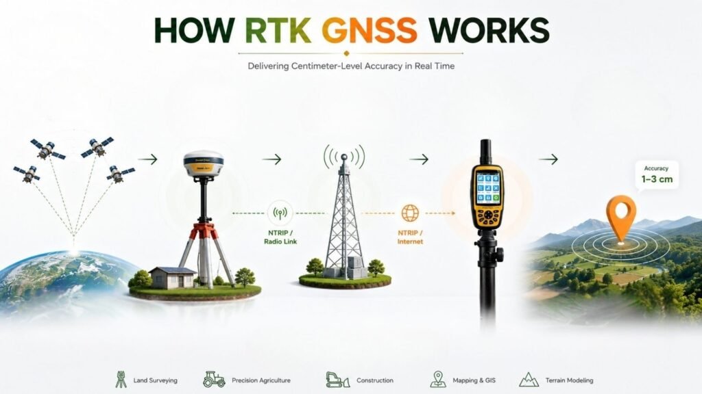
Step 1: Satellites Broadcast Signals A group of GNSS satellites is constantly sending out positioning data.
Step 2: The Base Station Receives Signals The base station sits at a location whose exact position is already known. Because that position isn’t in question, the station can work backward and figure out where the incoming satellite signals are off.
Step 3: Correction Data Is Generated From those calculated errors, the base station puts together correction information.
Step 4: Corrections Are Sent to the Rover That correction data travels to the rover through one of a few channels:
- Radio
- Internet (NTRIP)
- Cellular networks
Step 5: The RTK Receiver Calculates an Accurate Position The rover takes its own satellite readings, layers the correction data on top, and arrives at a position that’s accurate down to a few centimeters — all in real time.
None of this pauses for post-processing back at the office. It runs continuously, which is exactly what lets field teams keep moving instead of waiting around for results.
How Accurate is RTK GNSS?
Accuracy is really the whole pitch for RTK GNSS, so it’s worth putting some numbers next to it.
| Positioning Method | Typical Accuracy |
| Standard GPS | 3–10 meters |
| Differential GPS (DGPS) | 0.5–3 meters |
| RTK GNSS | 1–3 centimeters |
Real-world performance shifts depending on a few things:
- Satellite visibility
- Distance from the base station
- Communication quality
- Receiver capability
- Environmental conditions
Set up correctly, though, RTK tends to produce results that hold up consistently — reliable enough for the kind of work where “close enough” isn’t good enough.
Applications of RTK GNSS
RTK GNSS shows up across a fairly wide range of fields wherever precise positioning actually changes the outcome.
Land Surveying
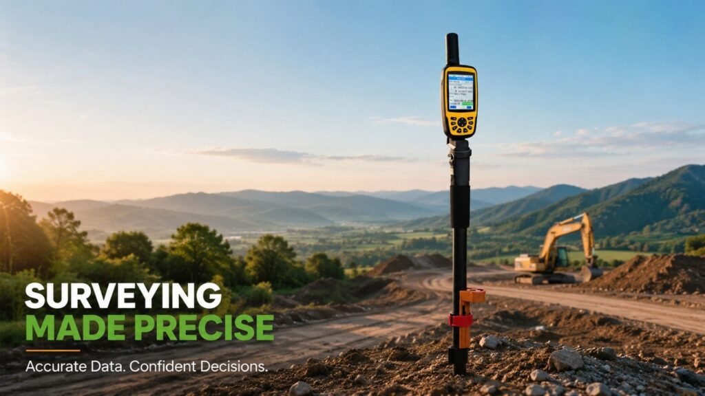
Surveyors need measurements that are accurate enough to stand up legally, whether that’s for boundary lines, engineering projects, or infrastructure work. RTK technology lets them:
- Perform boundary surveys
- Conduct topographic mapping
- Collect GIS data
- Measure construction layouts
- Reduce field time
- Improve data consistency
Survey equipment built around RTK lets teams gather accurate coordinates on the spot, without the extra step of post-processing everything later.
Precision Agriculture
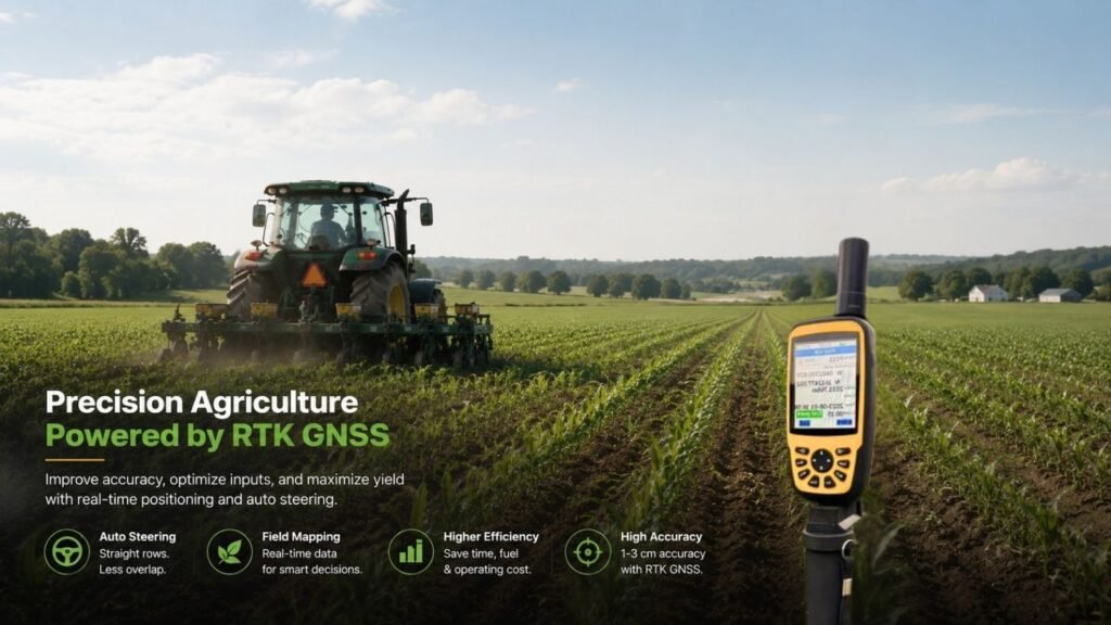
Farming has turned into something of a data business, and positioning accuracy feeds directly into how productive an operation can be. RTK GNSS lets farmers:
- Create accurate field maps
- Reduce overlap during planting
- Improve fertilizer application
- Optimize pesticide spraying
- Enable auto-steering systems
- Minimize fuel consumption
For precision agriculture specifically, guidance accurate to the centimeter helps push yields up while cutting down on wasted inputs and operating costs.
Construction
Every phase of a construction project depends on measurements being right. RTK GNSS helps crews:
- Stake out building foundations
- Position heavy equipment
- Perform site grading
- Measure earthworks
- Verify completed structures
- Monitor project progress
Get the positioning right, and rework drops off — which tends to keep the whole project closer to schedule.
Benefits of RTK GNSS
People across these industries don’t adopt RTK GNSS out of curiosity. It delivers advantages you can actually measure.
Centimeter-Level Accuracy Real-time positioning simply outperforms what conventional GPS can offer.
Higher Productivity Accurate positioning cuts down on repeated measurements and trips back out to the field.
Faster Data Collection Teams gather precise coordinates without sitting around waiting for office-based processing.
Better Decision-Making Reliable spatial data feeds into better planning, mapping, and project management.
Reduced Costs Fewer errors mean less wasted material, less wasted fuel, and less wasted labor.
Greater Operational Confidence Positioning that stays consistent lets a business run more efficiently across large-scale projects.
RTK GNSS vs Standard GPS
It’s an easy mix-up for beginners to make. Both technologies find location using satellites, sure, but their actual capabilities aren’t close.
| Feature | Standard GPS | RTK GNSS |
| Accuracy | 3–10 meters | 1–3 centimeters |
| Satellite Systems | Usually GPS | Multiple GNSS constellations |
| Real-Time Corrections | No | Yes |
| Professional Surveying | Limited | Excellent |
| Precision Agriculture | Basic guidance | Highly accurate |
| Construction Layout | Limited | Ideal |
GPS vs GNSS
There’s a related mix-up worth clearing up too: GPS vs GNSS.
GPS refers to one specific satellite navigation system, run by the United States. GNSS is the broader category — it takes in GPS along with GLONASS, Galileo, and BeiDou. Most modern RTK devices lean on several of these satellite systems at once, which is where the better accuracy and reliability come from.
How to Choose an RTK GNSS Device
Not every project needs the same level of positioning precision, so it’s worth weighing a few factors before settling on equipment.
Accuracy Requirements Pick equipment that can actually hit the precision your application calls for.
Multi-Constellation Support Receivers that support GPS, Galileo, GLONASS, and BeiDou tend to hold a more stable position overall.
Communication Options Look for support across:
- NTRIP
- Radio communication
- Bluetooth
- Wi-Fi
- Cellular connectivity
Durability Fieldwork rarely happens in ideal conditions. Look for equipment built with:
- Water resistance
- Dust protection
- Shock-resistant construction
Battery Life Longer battery life means fewer interruptions during a long day in the field.
Software Compatibility Make sure the receiver plays well with whatever GIS, CAD, surveying, or agricultural software you’re already using.
How Dream Origin Supports Precision Positioning
Surveying, agriculture, engineering, construction — these fields all need positioning tools that hold up in daily field use, not just on paper.
Dream Origin builds professional GNSS equipment around exactly that requirement, with a lineup covering mapping, land surveying, precision agriculture, and engineering workflows.
One example is the H60 Handheld GNSS RTK Device, a portable option built for professionals who need high-precision positioning without hauling around heavier gear. Backed by modern GNSS technology and RTK correction services, a handheld device like the H60 can simplify data collection and help teams keep measurement quality consistent from one project to the next.
Matching your equipment to your actual workflow tends to make day-to-day operations noticeably smoother — whether that’s collecting GIS data, managing agricultural fields, or running engineering surveys.
Frequently Asked Questions
1. What does RTK GNSS stand for? RTK GNSS stands for Real-Time Kinematic Global Navigation Satellite System — a technology that delivers real-time, centimeter-level positioning through satellite corrections.
2. How accurate is RTK GNSS? Most professional RTK systems land around 1–3 centimeters of horizontal accuracy under decent operating conditions.
3. Is RTK better than standard GPS? Yes. Standard GPS generally gives you meter-level accuracy, while RTK GNSS gets down to centimeters, which is what professional applications actually require.
4. What industries use RTK GNSS? RTK GNSS shows up widely across:
- Land surveying
- Precision agriculture
- Construction
- Civil engineering
- GIS mapping
- Mining
- Infrastructure inspection
5. Does RTK GNSS require an internet connection? Not necessarily. Correction data can arrive through:
- NTRIP over the internet
- Radio communication
- Local base stations
Which method you use comes down to your equipment and how the project is set up.
6. What is the difference between GPS and GNSS? GPS is one satellite navigation system. GNSS covers multiple global satellite systems — GPS, Galileo, GLONASS, BeiDou — which is where the better coverage and positioning reliability come from.
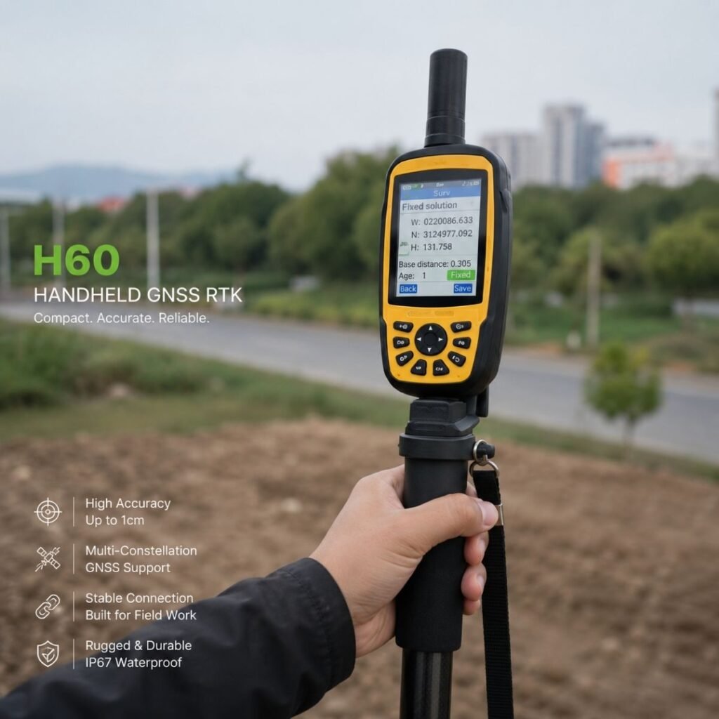
7. Can handheld RTK devices be used for professional surveying? Yes. Handheld GNSS RTK devices are commonly used for GIS mapping, utility inspections, asset management, environmental surveys, and a good deal of other professional field work where portability and accuracy both matter.
Conclusion
As more industries lean into digital workflows, accurate positioning has quietly become central to improving productivity, cutting costs, and making better decisions in the field.
RTK GNSS provides the precision that modern surveying, construction, engineering, and precision agriculture actually need, by pairing satellite navigation with real-time correction. Set against standard GPS, the accuracy gap is substantial enough to make it a worthwhile investment for any organization that depends on trustworthy spatial data.
Whether you’re running a land survey, managing agricultural operations, or planning out infrastructure, picking the right GNSS solution can improve efficiency and lead to more consistent results.
If you’re looking into professional-grade GNSS technology, Dream Origin offers a range of positioning solutions — including the H60 Handheld GNSS RTK Device — built to support accurate, efficient fieldwork across a variety of industries. Explore Dream Origin’s GNSS product lineup to find the solution that fits your operations.